UPDATE - Monday 7:00 p.m.
Authorities have reassured Fernie residents that their safety is not at risk from the Coal Creek FSR fire at this time.
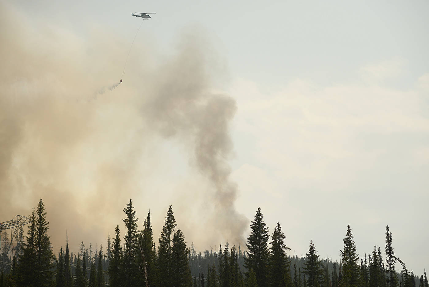
The wildfire remains at a size of 713ha, and is now being worked on by 14 firefighters, a bucketing helicopter and five pieces of heavy equipment.
The heavy equipment has completed 95 per cent of a machine guarded barrier around the perimeter of the fire. The fire district clarified that this does not mean the fire is 95 per cent contained, but this method does help in slowing down the fire. A machine guard is a achieved by scraping down a four-metre wide line around the perimeter of the fire, in order to remove fuels and discourage the fire from travelling.
The Fire Centre is asking that all curious onlookers obey road closures and stay away from the area while the heavy machinery is in use. Signage and barricades are in the process of being posted on closed service roads.
Continue tracking The Free Press and City of Fernie website for any alerts in relation to current wildfire situation, and remember to have a 72 hour preparedness kit ready in case of an emergency.
-
UPDATE - Monday 3:00 p.m.
Fernie’s rifle and archery ranges have been closed as a large wildfire continues to burn approximately 12 km down Coal Creek Forest Service Road.
The Fernie Rod and Gun Club (FRGC) announced the closure of the FRGC Rifle and Archery Ranges late Sunday following the partial closure of Coal Creek FSR.
It will remain closed until further notice.
The Rod and Gun Club announced on social media that anyone caught using the FRGC rangers while they are closed will risk the loss of their membership and be reported to authorities.
The FRGC 3-D Archery Summer Shoot and Elk Valley Extreme has also been cancelled and will be rescheduled for another date.
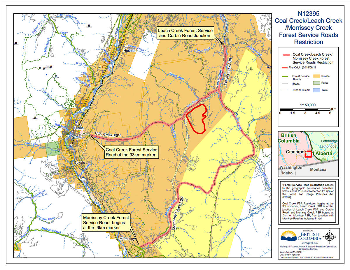
Coal Creek Road is currently closed at the 33km mark, which is located at the River Road-Ridgemont Road intersection. Anyone who proceeds past this point faces a $173 fine under section 22.2 of the Forest and Range Practices Act.
No new information about the Coal Creek FSR fire has been released since yesterday morning.
-
UPDATE - Sunday 9:30 a.m.
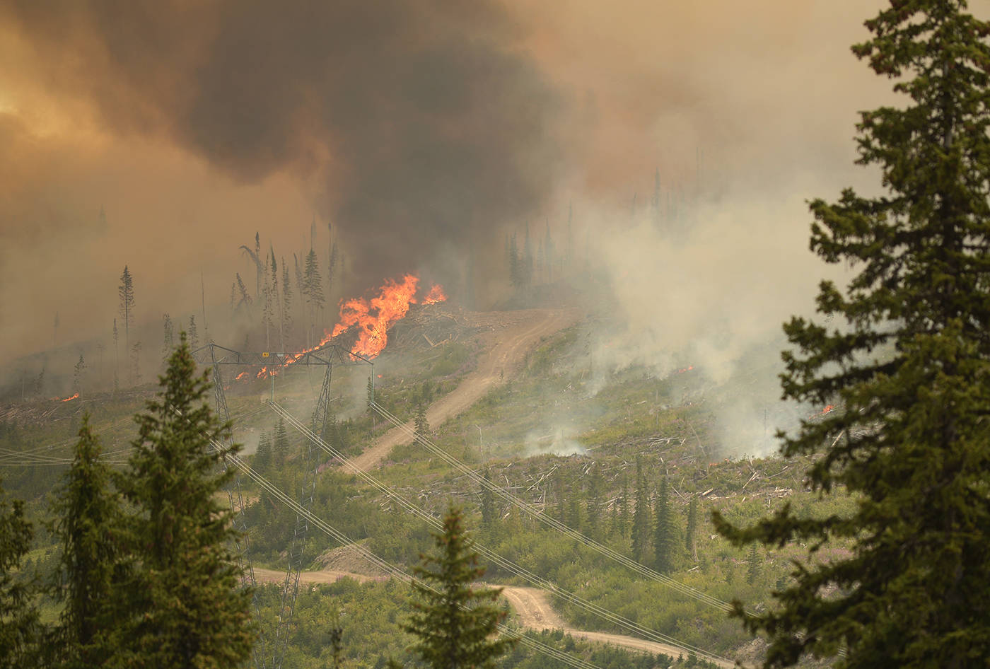
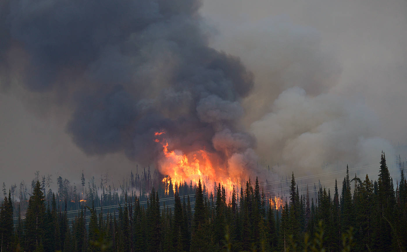
The Coal Creek Road fire has grown to 713ha in size and is still burning out of control.
According to BC Wildfire Service, the fire is about 12km east of Fernie and displaying “vigorous fire behaviour”.
It is highly visible from Fernie and Alberta, however, it is not currently threatening communities.
The latest update from BC Wildfire Service shows five heavy equipment continue to build containment lines on the south side of the fire.
A bucketing helicopter is also on site.
Road closures remain in place and the cause of the fire is still under investigation.
—
UPDATE - Saturday 6:30 p.m.
The BC Wildfire Service is reporting Coal Creek Road closed at the 33km mark. Surrounding service roads are also closed. Visit BC Wildfire Service’s website for an extended list.
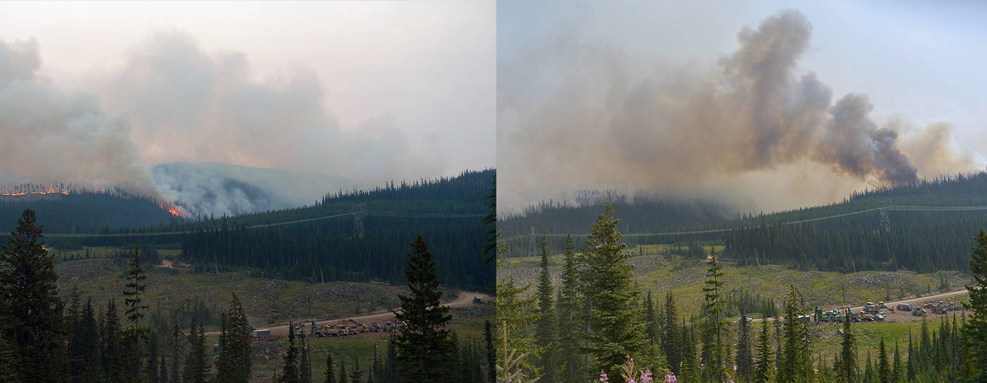
The fire is estimated to be approximately 528.0ha in size, 12 kilometres east of Fernie, and is zero per cent contained.
There is one bucketing helicopter and five pieces of heavy equipment on site. They are working to build containment lines on the south side of the fire.
The fire is highly visible from Fernie and Alberta but is not currently threatening communities.
-
UPDATE - Saturday 2:30 p.m.
The closure of Coal Creek Road is imminent as a large wildfire rages 14km east of Fernie.
On Saturday morning, the blaze was reported as 512ha in size, however, by 2:30 p.m., it had reached roughly 650ha.
According to the BC Wildfire Service incident commander on site, the agency is doing what it can with limited resources and multiple fires burning around the region.
He said the closure of Coal Creek Road was imminent, with large boulders becoming dislodged by the fire and rolling onto the road.
One helicopter with water support is on scene and water bombers have been requested.
The fire is still considered out of control with wind blowing from the southeast.
—
UPDATE: A wildfire 14km east of Fernie is now more than 500 hectares in size and burning out of control.
A BC Wildfire Service spokeswoman on Saturday confirmed the fire along Coal Creek Road had grown to 512ha and was not yet contained.
A helicopter is enroute to bucket the fire, which was discovered on Friday and initially reported as 20ha in size.
The fire is highly visible from Fernie and nearby areas, however, there is not believed to be any threat to property at this time.
BC Wildfire Service is expected to issue another update later this afternoon.
More to come.
—
Earlier it was reported:
A wildfire approximately 15 kilometres down Coal Creek Road near the township of Fernie is estimated to be above 150 hectares in size.
The last estimation in size was made from the air by BC Wildfire Service, about four hours ago. The fire started at approximately 2:30 p.m today, August 10. The fire is suspected to be person caused.
Currently there is no risk to property or houses.
Logging crews are currently working on securing their equipment at the base of the mountain where the fire is burning.
Once equipment is secured, Rocky Mountain Forest District will work on establishing a road closure for public safety.
There are currently no BC Wildfire Service crews on site at the Coal Creek fire. Around the same time that the Coal Creek FSR fire started, more fires arose near the town of Kimberley that were deemed more of a threat to the safety of the public, so crews have been focusing their efforts on those.
The Wildfire Service will re-evaluate the fire in the morning. A fire technician on site said that their number one priority is public safety.