Heavy rainfall is expected to continue in the Elk Valley over coming hours, with a rainfall warning active through to Tuesday, and a flood warning issued by the River Forecast Centre on Monday morning.
Between 50 and 80mm of rain is expected to fall between now and Tuesday, with “the highest amounts around Fernie” according to the River Forecast Centre.
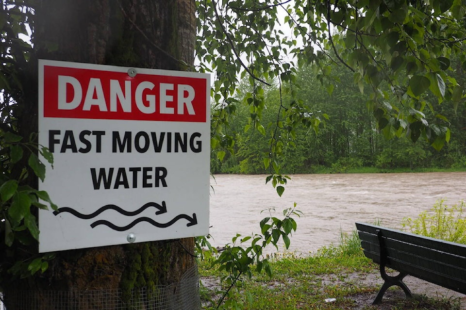
The Elk River is the only region in the Kootenays with an active flood warning, with the rest of the region on flood watch.
The Elk River region includes the entire Elk Valley, including the communities of Sparwood and Elkford and RDEK Area A.
According to the City of Fernie, the Elk River was at a level expected during spring freshet. The city activated its Emergency Operations Centre (EOC) on Monday in response to the rainfall and flood warnings.
There were no reports of local flooding in the Fernie area as of Monday morning. Coal Creek, which has been chewing away at the riverbank to the east of town also appeared to be manageable.
Coal Creek Rd was closed by the City of Fernie on June 10 due to extensive erosion to parts of the road that were only recently repaired after the November 2021 rainfall events. City staff were monitoring the creek, but said there were no significant concerns downstream, in the City of Fernie, at that time.
Public self-fill sandbag stations have been set up in two locations in town, at Railway Ave and Ridgemont Ave (next to TJs Autobody) in maintown, and at the Main Sewage Lift Station parking lot off Mt McLean Dr in the Mountain View subdivision.
The city has closed Thompson Park in West Fernie for city operations to prepare and stage sandbags, while many trails in the city near the river have been closed out of an abundance of caution.
The James White trail network has been closed, as has the trail between Dogwood Park to Park Ave Bridge. The Annex Park Inner Dike Trail network is closed, and the section of trail by the Fernie RV Park.
In Sparwood, the district has set up a self-fill sandbag station on Engelmann Spruce Dr, past the mainroad yard and Fire Hall #1. Sandbags are provided, but residents are asked to bring their own shovels and gloves.
Keep up to date on alerts by visiting the BC River Forecast Centre website, the Environment Canada website, and sign up for the Regional District of East Kootenay evacuation notification system by clicking here. Your local municipality will also be updating their social media pages with pertinent information as it comes available.
READ MORE: Flood warning issued for Elk River
scott.tibballs@thefreepress.ca
Like us on Facebook and follow us on Twitter