The condition of multi-use trails around Fernie in the aftermath of the torrential rain on Sunday and Monday is a mixed bag, with parts of the Montane trail network potentially closed until the Spring thaw, while the provincial park area trails and Fairy Creek area trails were relatively untouched.
According to Pat Gilmar, who is a director with the Coal Creek Heritage Society, damage to both upper and lower trails in Montane was going to take a lot of work to repair.
“Along Coal Creek dike area about half of the trails are wiped out. The other half are badly damaged,” he said, but added that they were aware that those trails were always at risk ‘We knew they’d be blasted out one day, (being) built on the flood plain level, it’s no surprise.”
Further up the hill, things were a little better.
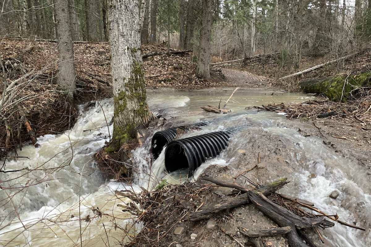
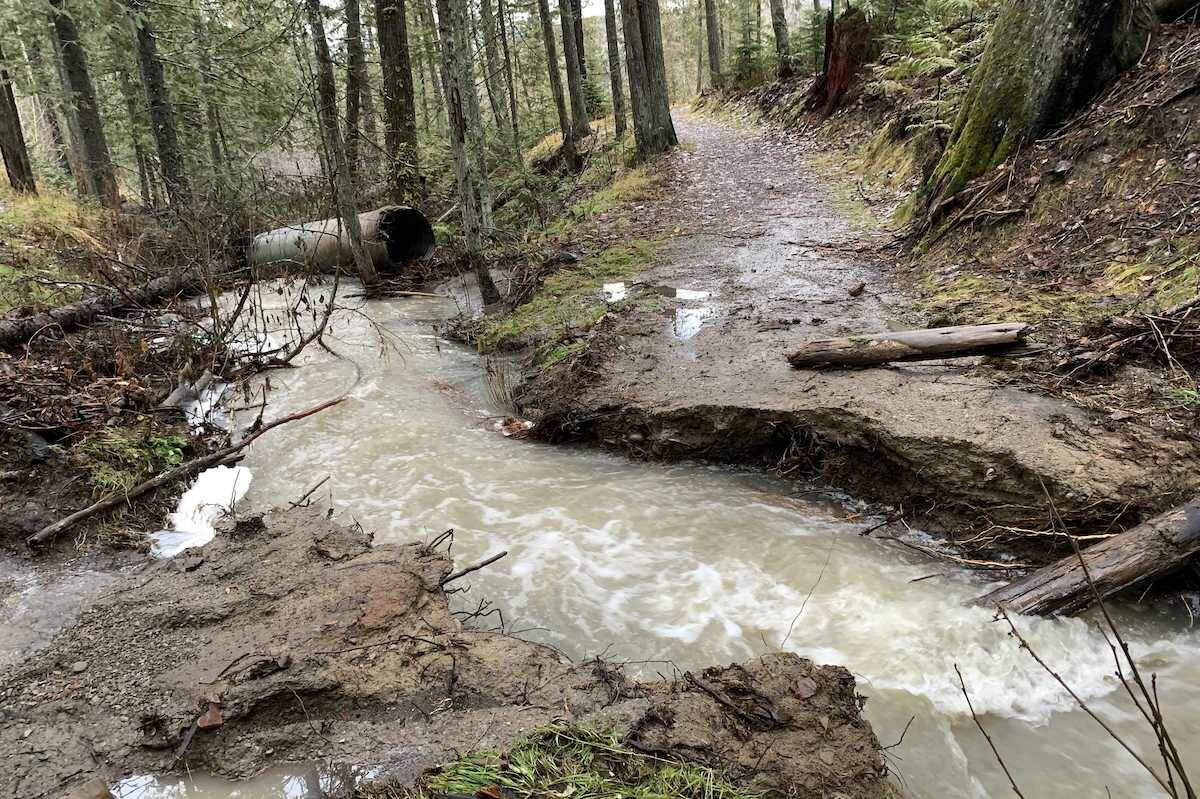
“In the upper trails, where the creek drainage were, about every second culvert was wiped out.”
Gilmar said the adaptive trail in the network had been compromised in three to four places, with culverts washed out despite the robustness of the infrastructure.
Gilmar said that repairing the damage was a tall order, given a day after the rain stopped, temperatures dropped to -10 degrees overnight.
“Unfortunately it’s the wrong time of year with the freezing conditions. All that moisture in the ground froze solid.”
For now, icy conditions were too dangerous for crews to work on repairs, and too dangerous for riders to have free reign of the whole network, so “bottom line, next spring, next summer we’ll be repairing.”
That doesn’t mean Montane’s closed off completely though, especially as snow will allow ruts to be groomed over.
“On the upper trails we’ll be grooming for fat biking,” he said.
“(But) early season, low snowpack, definitely too dangerous for the crews and the riders.”
Coal Creek Heritage Society is also responsible for the Ridgemont Trail network, and Gilmar said that closures there were expected to be more temporary, though there were some small mudslides and areas with trees down.
Elsewhere, trails such as Swine Flu and connecting trails to the north of town were seemingly untouched, with no washouts or pooling water. Trails like Smooth Salamander and Snoop Lion were in a bad way due to the number of creeks that crossed under them, and trails in and around the Mount Fernie Provincial Park were affected by debris and some pooling water.
Chair of the Fernie Trails Alliance (FTA), Krista Turcasso said that the FTA was actively inspecting the trails they manage and recording where maintenance efforts will need to be focused, both now and when the spring thaw comes.
She said that these efforts were ongoing in order to record maintenance needs before any damage disappeared underneath the snow.
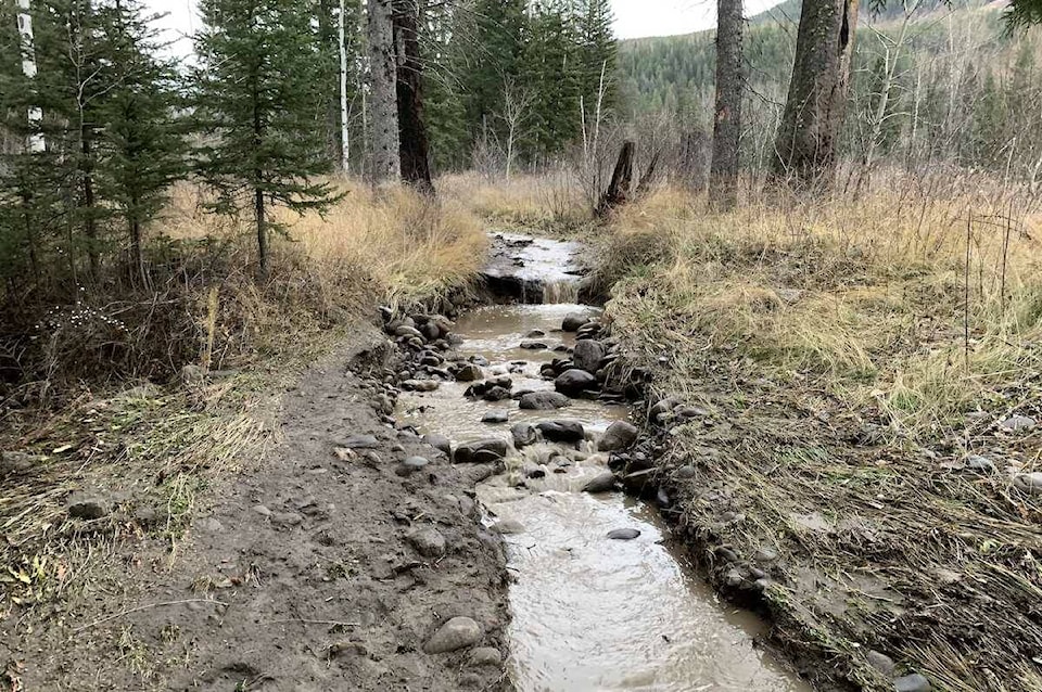
“Many trails have been impacted with high volume water run off creating or accentuating any ruts, and numerous locations will require repair work in the spring,” she said.
“High winds have also caused significant amounts of blow down. Trail champions and volunteers have already been out clearing trails, and the FTA doesn’t see it affecting winter use.”
The Trans Canada Trail, which the FTA manages between Hosmer and Elko, has seen extensive damage according to Turcasso.
“Abnormally high flow levels in some creeks have damaged or destroyed some trail infrastructure such as culverts and bridges.”
She said that the FTA would be prioritising repairs based on severity of damage and importance to the connectivity of the network.
“The FTA hopes to locate funding sources during the winter season to ensure these trails are usable come next summer.”
In the meantime, trail crews continue to clear downed trees to ensure trail users will be able to use the trails over winter.
READ MORE: Hwy. 3 could do with an upgrade at Hartley Creek: Wilks
scott.tibballs@thefreepress.ca
Like us on Facebook and follow us on Twitter