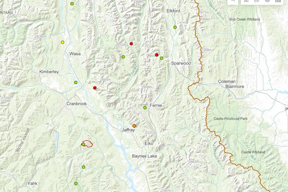
There are two new, small wildfires in (and near) the Elk Valley, one by Mt. Fernie and another by First Creek near Jaffray.
According to the B.C. Wildfire Dashboard, the fire near Jaffray ignited on Sunday (Aug. 28), with lightning as the suspected cause. Its estimated size is 0.02 hectares, and is listed as new as of Monday (Aug. 29) morning.
The second fire by Mt. Fernie was ignited on Saturday (Aug. 27), also with lightning as the suspected cause. Its estimated size is 0.02 hectares, and is under control.
On Sunday evening, the Fernie Trails Alliance (FTA) posted on Facebook that Slunt and Brokeback trails, which were closed due to the Mt. Fernie fire, were to be re-opened on Monday.
“BC Wildfires should have all gear out by around 8 p.m. tonight (and) trails will be good to go for tomorrow,” the post said, adding a thank you to everyone for understanding and keeping clear of the area.
The Cummings Creek wildfire near Sparwood is listed as under control with an estimated size of 52.60 hectares, and just west, the Telford Creek fire is listed as out of control with an estimated size of 0.01 hectares.
The Fording River fire south of Elkford is listed as under control at 2.58 estimated hectares.
The BC Wildfire Service posted on Sunday afternoon that two of the three larger wildfires in the Southeast Fire Centre are no longer wildfires of notes, but that area restrictions remain in place at three fire sites to allow crews to complete their work safely.
Two of the area restrictions are for fires in the East Kootenays.
One is a fire of note by Weasel Creek along the border with Montana, burning at an estimated size of 1,088.30 hectares. The other is the Connell Ridge fire south of Cranbrook, which is listed as under control at an estimated 1,719.20 hectares.
For more information about wildfires in the region, visit the B.C. Wildfire Dashboard here.
READ MORE: Area restriction rescinded for Cummings Creek fire, west of Sparwood
@fishynewswatch
josh.fischlin@thefreepress.ca
Like us on Facebook and follow us on Twitter.