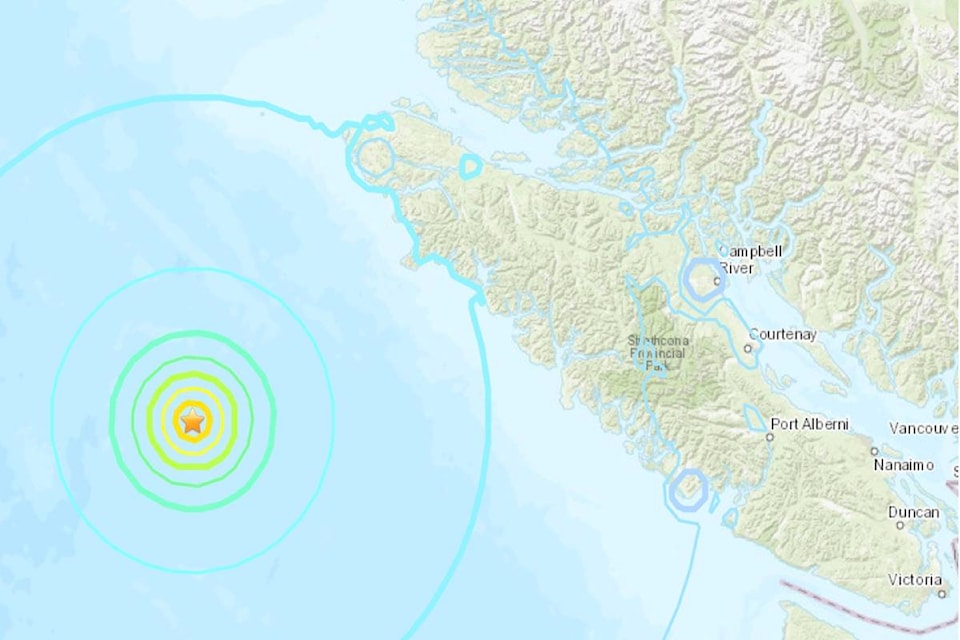
Three relatively strong earthquakes, followed by two smaller ones were recorded Sunday night in the Pacific Ocean off Vancouver Island.
The U.S. Geological Survey reported a 6.6 magnitude quake about 260 kilometres west of Tofino, followed by a 6.8 tremor and then a third measuring 6.5. There have been no reports of damage or injury and a tsunami is not expected.
Survey geophysicist Zachary Reeves said all three quakes occurred in the same general area over the course of about an hour, and at a shallow depth of approximately 10 kilometres. The two other earthquakes that followed were magnitude 4.9 and 4.0.
Reeves, based in Golden, Colorado, described the quakes as “pretty big.”
Emergency Info BC tweeted that the quakes were felt in parts of the province but there were no reports of damage or injury and no tsunami warning was issued.
Multiple #earthquakes felt in parts of #BC, but no reports of damage or injury.
— Emergency Info BC (@EmergencyInfoBC) October 22, 2018
NO Tsunami threat. RT @USGSBigQuakes: Prelim M6.5 Earthquake Vancouver Island, Canada region Oct-22 06:22 UTC, updates https://t.co/hvAEGnVOmW
British Columbia is located on the Pacific Ring of Fire, an active seismic zone where thousands of mostly small earthquakes are recorded annually by sensors in the province.
Most of the quakes happen near the Cascadia subduction zone, an area where the Juan de Fuca and North American tectonic plates converge, stretching from Vancouver Island to northern California.
An earthquake early-warning system recently tested off the B.C. coast could give residents anywhere from 20 seconds to two minutes to prepare before a quake.
The first-of-its kind warning sensors developed by Ocean Networks Canada is installed along the Cascadia subduction zone and when fully operating next March will be able to estimate location and magnitude of a megathrust earthquake.
The Canadian Press