Submitted
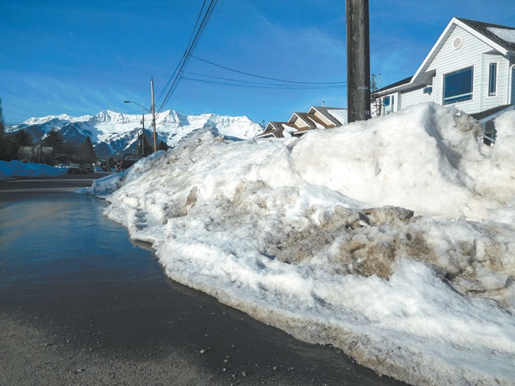
Is there a lake forming on your street as the snow melts? We are certainly seeing more snow in the valley bottom than we have in several years, and with the warming weather people are now turning their focus from shoveling and skiing to the Elk River and flooding.
Is the Elk River going to flood this year? How high will the river get? How will I know if the river will flood before it’s too late? What can I do to protect my property?
Floods are difficult to predict; there are no hard and fast answers to these questions. Something you can do to put your mind at ease is be informed about flooding and be prepared with a personal plan.
The first thing to know is how much of a snowpack there is, especially high up in the mountains. Almost all of Fernie’s major floods occurred at the peak of snow melt and with a corresponding large rain event. It is difficult to predict when high temperatures and rains will occur, but we can monitor the snowpack.
The B.C. government website has real-time and historic snow pillow data from a station on Morrissey Ridge just south of Fernie. Currently, the snowpack is close to average; actually it is slightly below the level it was at this time last year. So while there are mountainous snow banks in town the snowpack itself does not raise alarm bells.
Secondly, become flood aware. Start with the Elk River Alliance’s Elk River Flood Strategy from 2016 outlining the history of flooding in the Elk Valley, its ecological significance, and proactive steps for individuals and community members can take to properly prepare themselves. This can be accessed from Elkriveralliance.ca
Next steps to becoming flood prepared include determining where your property is in regards to the flood plain (see the cool simulation model in the strategy of where water innundation is expected between Hosmer and Coal Creek); monitoring the local weather forecast during the spring for warm, wet weather; monitoring water flow levels (available at Wateroffice.ec.gc.ca); and reviewing the emergency preparedness procedures in the strategy and on local government websites.
As a homeowner, there are many things you can do to flood proof your home. Know where and how to turn off the water, electricity and gas to your home. Move appliances and valuables up off the ground.
When the river levels start to rise and flooding looks imminent, authorities will patrol dikes, monitor critical infrastructure and may begin to take precautionary measures. Should flooding occur, the first sources of information are the rdek.bc.ca and other municipal government websites. This is where information will be provided regarding the emergency procedures. Local media i.e. radio, newspaper, Facebook, etc. will also be used to communicate with the public.
In the event of severe flooding, people may be evacuated from their homes and relocated to reception centres set up in local community halls like Fernie’s Community Centre. Local municipalities may request a state of emergency with emergency steps such as the deployment of equipment to maintain key infrastructure. Community Emergency Operation Centres will act as a hub for the coordination of flood response efforts.
Floods have been a part of our past and living with flood risk in the future is a reality we must face together. We should all be smarter after every flood event. It is essential to be informed, be prepared and have a plan in place to more effectively respond to the next flood event.