Dangerous avalanche conditions are expected to be heightened this weekend as Fernie heads towards days of heavy snowfall.
“We expect danger to increase over the weekend with the incoming conditions,” said Wendy Lewis, avalanche forecaster with Avalanche Canada.
The Weather Network has issued a special weather statement alerting about heavy snow in the Elk Valley. A total accumulation of 15 up to 30 centimetres is expected between Friday evening and Saturday afternoon.
READ MORE: Avalanche danger rating rises in East Kootenay
“We’re looking at new snow sitting on the crust that was formed by the rain events last week,” Lewis said.
She said it rained “quite high up onto the mountains” in the region, and the bonding between the new snow and the old interface is, in general, “bonding quite poorly.”
“The crust creates a really good sliding layer. And in the case of the Lizard-Flathead and the South Rockies, it’s a very smooth, icy crust.”
Whenever new snow is added to a snowpack, it takes time to stabilize and bond to the older layer.
“That’s definitely something we’re thinking about with this new storm this weekend.”
The combination of heavy snowfall and strong winds adds load and stress to the snowpack, and it takes time to gain strength. Warming temperatures are also a factor that could make conditions more avalanche-prone.
“With a problematic layer like that crust, it might take a lot longer for that to gain strength. And it could be a tricky layer for a while.
“To put it simply, that crust is not going anywhere.”
READ MORE: City receives new avalanche modelling for area
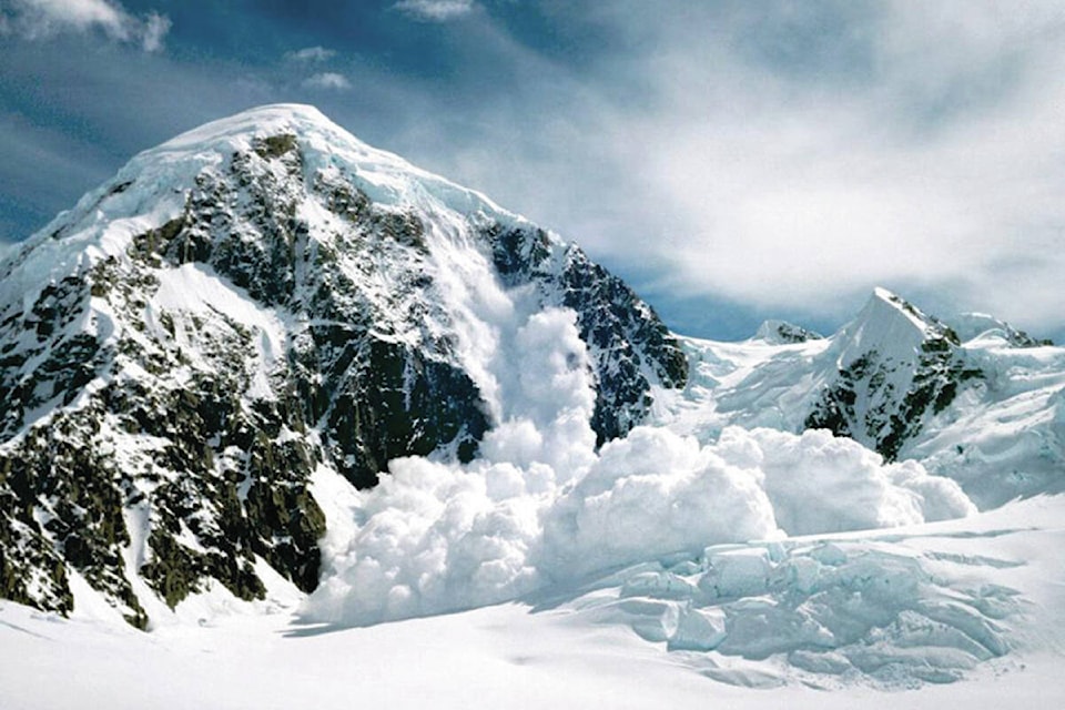
There has already been “significant avalanche activity” this season.
“Recently, the Lizard Range has seen avalanches running on that melt-freeze crust in the last few days.”
The South Rockies area has seen less snowfall and thus less avalanches, though it has still seen some.
Anyone heading out into the mountains should watch for signs of instability, she said, and recent avalanches are the best indicator.
“Ideally, if there’s visibility on surrounding slopes or anything like that, that’s an absolutely great way to have a look.”
Checking Avalanche Canada’s forecast is also recommended.
“We encourage them to read the forecasts and understand what the problems are before they head out into the mountains.”
Taking an avalanche skills training course is also a good avenue to gain knowledge and skills, she said.
Avalanche Canada’s website has more travel and terrain advice, for those interested.
“The possibility of avalanches is always present out there, but it’s increasing danger going into this weekend with snowfall, with winds, and with warming temperatures,” Lewis said.
“We say: if there’s enough snow to ride, there’s enough snow to slide.”
Avalanche control in-bounds at the Fernie Alpine Resort is carried out daily.
READ MORE: Fernie man dies in avalanche
@fishynewswatch
josh.fischlin@thefreepress.ca
Like us on Facebook and follow us on Twitter.