The Cummings Creek wildfire of note has grown slightly to over 52 hectares according to the latest update from the BC Wildfire Service.
The fire, which is 5km west of Sparwood in a steep forested area known locally as the Wilson Draw has been burning since August 3. It is currently burning slowly up the hill it started on, while efforts are being made to cool it’s northern flank and slow it from crossing Cummings Creek.
“Over the past several days, fire activity has continued within the perimeter and some growth has been observed on the southwest flank,” reads the August 12 BC Wildfire Service update.
“The fire has backed into the wetter areas around the Cummings Creek and growth in the north and easterly directions has slowed, which has allowed the opportunity for crews to safely work on building limited access/egress routes.”
Currently, efforts to fight the fire on the ground have been limited by the steep terrain, with the fire sending debris and boulders down the hill from where it’s burning. In a community information centre, local Incident Commander, Scott Rennick said that putting boots on the ground would put firefighters right below where the debris is coming from.
READ MORE: Sparwood gets update on Cummings Creek wildfire activity
Efforts instead are focused on cooling the northern flank of the fire with helicopter bucketing, and contingency planning in the community of Sparwood.
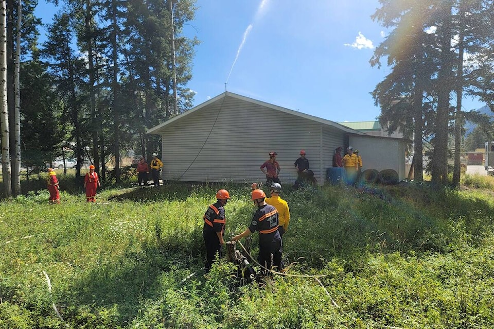
The wildfire service has sent two 20-person units to build access routes and contingency lines where safe to do so, while structure protection teams are working to conduct practice drills to set up structure protection sprinklers, pumps and bladders, and practice water shuttling.
Fire crews and resources from around the province are working in the area. Home base for the majority of the response team is Elko, due to its central location between the Cummings Creek, Weasel Creek and Connell Ridge fires of note. Firefighters are also tenting in Fernie.
Up-to-date information on the fire can be found on the BC Wildfire Service website, here, and on the RDEK website, here. Social media accounts of the responsible agencies are also regularly updated. Residents are also encouraged to sign up for the regional evacuation alert system through the RDEK.
READ MORE: Environment Canada warns of reduced air quality in Elk Valley
scott.tibballs@thefreepress.ca
Like us on Facebook and follow us on Twitter