UPDATE: 3:50 p.m.
The McDougall Creek wildfire is now an estimated 12,270 hectares in size.
On the scene for Tuesday are, 71 firefighters, 15 operational field staff and 15 helicopters.
There will be 27 personnel working overnight and 172 structure protection personnel are working throughout the day.
West Kelowna Fire Chief Jason Brolund said he expects structure losses in his community and on Westbank First Nation lands to be less than 90.
Fire crews also believe there will be fewer than 70 full and partial property losses in West Kelowna and less than 20 in Westbank First Nation.
____
UPDATE 11 a.m.
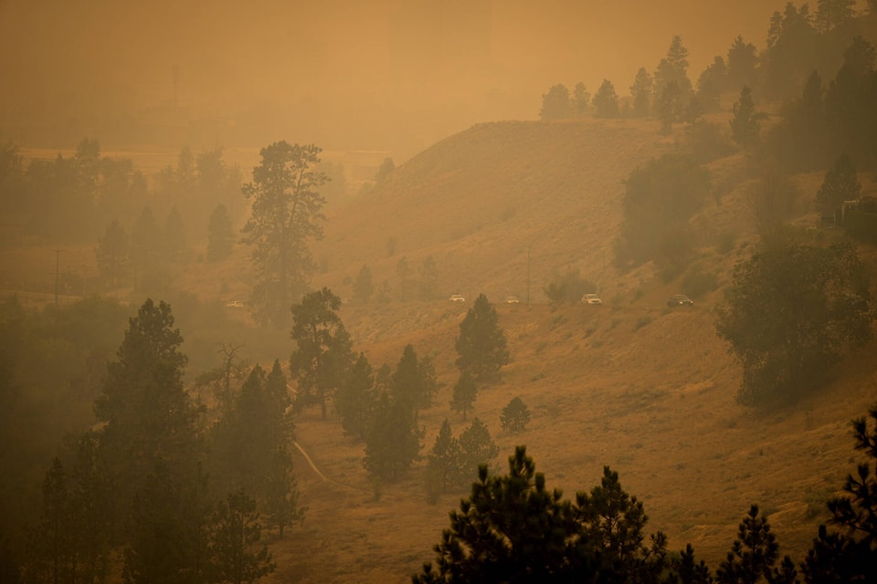
Because of the weather forecast, smoke is expected to lift somewhat during the day on Tuesday, improving visibility for BC Wildfire Services and the West Kelowna Fire Department.
The smoke that has few days has kept temperatures cooler, keeping fire activity at a rank 2 and 3.
Structure protection crews worked throughout the night and into Tuesday mopping up hotspots around houses and conducting tactical patrols. Some of the hotspots have been behind proporties on Bartley Road while crews are constructing hand guards in the Shannon Heights area. Heavy machinery is also being used in the areas as well to help make a guard between Bartley Road and Shannon Lake Estates.
Wildfire crews are also working with BC Hydro to extinguish burning power poles and clear road access.
At the north end of the blaze, crews are on site with additional heavy machinery, line locators, and tree assessors. Some crews will be establishing a hand guard and wet-lining the north fire perimeter.
UPDATE: 9 a.m.
After showing no growth overnight, the McDougall creek wildfire has grown to 12,000 hectares in size.
Now burning for a week, since being discovered on Tuesday, Aug. 15, crews remain on the scene. Visibility has been challenging and has limited the ability to get an updated aerial track.
ORIGINAL: 5:09 a.m.
The McDougall Creek wildfire continues to burn north of West Kelowna on Tuesday morning (Aug. 22).
Now entering day eight of the blaze, it remains at 11,000 hectares and out of control and some areas continue to experience increased fire activity. Because of heavy smoke in the area, BC Wildfires crews haven’t been able to update the size of the fire.
On Monday night (Aug. 21), the Central Okanagan Emergency Operations Centre rescinded the evacuation order for the following West Kelowna properties and placed them on evacuation alert due to McDougall Creek fire.
All properties on 2210 Horizon Drive.
The following Smith Creek properties:
* 3031 ELLIOTT RD
* 3081 ELLIOTT RD
* 3101 ELLIOTT RD
* 3121 ELLIOTT RD
* 3131 ELLIOTT RD
* 3133 ELLIOTT RD
* 3135 ELLIOTT RD
* 3137 ELLIOTT RD
* 3139 ELLIOTT RD
* 3141 ELLIOTT RD
* 3143 ELLIOTT RD
* 3131 HAROLD RD
* 3161 HAROLD RD
* 3106 SMITH CREEK RD
* 3112 SMITH CREEK RD
* 3118 SMITH CREEK RD
* 3124 SMITH CREEK RD
* 3148 SMITH CREEK RD
* 3154 SMITH CREEK RD
* 3160 SMITH CREEK RD
* 3164 SMITH CREEK RD
* 3168 SMITH CREEK RD
* 3172 SMITH CREEK RD
* 3178 SMITH CREEK RD
* 3184 SMITH CREEK RD
ABEL PL
ABEL ST
ALEXANDER PL
BAYVIEW CRT
BEACH VIEW LANE
BROOKSIDE PL
CAMPBELL PL
CAMPBELL PLACE
CAMPBELL RD
CAWSTON AVE
CREST RIDGE LANE
DERRICKSON PL
ESSEN RD
FERRY WHARF RD
HARBOUR GREEN RD
HARBOUR POINTE LANE
HARBOUR VIEW BLVD
HARBOUR VIEW CRES
HIGHWAY 97
HIGHWAY 97 S
HIGHWAY 97 S
HORIZON DR
KATHERINE RD
LAKE BREEZE RD
LAKE VISTA DR
LAKE VISTA RD
MANUEL RD
MARINA WAY
MARINA WAY E
MICHELLE CRES
NANCEE WAY
NANCEE WAY CRT
OLD FERRY WHARF RD
ROSIE DR
SNEENA RD
SPLAND RD
TOMAT AVE
VIEWPOINT CRES
VIEWPOINT DR
WATERS EDGE LANE
WESTSIDE RD
WESTSIDE RD S
Residents on evacuation alert should be ready to leave their properties at any time.
map
The following areas located in Westbank First Nation remain on evacuation order:
* Sookinchute Court (all properties)
* Lindley Drive (all properties)
* 1525 Bear Creek Road (all properties)
* 1555 Bear Creek Road (all properties)
* 1595 Bear Creek Road (all properties).
For a map of evacuation orders and alerts visit cordemergency.ca/map.
Also late Monday night, a new wildfire was discovered in Fintry, which was already on evacuation order. The Shorts Creek wildfire was discovered at 7:41 p.m. and was quickly doused by firefighters. It is now under control.
The McDougall Creek wildfire is now part of the Grouse Complex since Saturday night. It is a Grouse Complex with the Walroy Lake wildfire in Kelowna and the Clarke Creek wildfire in Lake Country.
All indoor and outdoor services in West Kelowna have been postponed until further notice, including all summer camps, Park Play Day, sports fields and ice arenas including Jim Lind Arena and Royal LePage Place.
Transport Canada and the BC Wildfire Service prohibit the use of drones of any size near a wildfire. The operation of any aircraft not associated with fire suppression activities within a radius of five nautical miles around a fire, including unmanned aerial vehicles (UAVs or drones), is illegal. Anyone found interfering with wildfire control efforts may face penalties up to $100,000 and or up to one year in jail.
Black Press Media will keep updated throughout the day.
READ MORE: Possible sweet relief as rain falls in Okanagan
@cunninghamjordy
jordy.cunningham@kelownacapnews.com
Like us on Facebook and follow us on Twitter and subscribe to our daily and subscribe to our daily newsletter.